Singapore Chinatown - Telok Ayer (Hokkien Area)
- Marc Michelmann
- Sep 20, 2020
- 11 min read
Updated: Sep 28, 2025

View of Telok Ayer Bay from nearby Mount Wallich prior to the start of land reclamation in the 1880's. Clearly visible is Nagore Dargah, Thian Hock Keng and Al-Abrar Mosque.
Source: https://mothership.sg/2018/04/jackson-plan-singapore/
In the past, Telok Ayer was situated along the old shoreline of Singapore and was a landing ground for immigrants, hence giving its name Telok Ayer in Malay which translates to “bay” and “water” . Given the congregation of Chinese immigrants, it led to a concentration of temples and clan associations in the area . Some of these clan associations include Singapore Hokkien Huay Kuan, the Ying Fo Fui Kuan- a Hakka clan association, and Keng Teck Whay – a welfare association set up by 36 Hokkien families who came down from Malacca. Raffles also recognised the benefit of the different Chinese communities settling into different areas of town, based on precedence and numbers. Hokkiens, being the first and the most numerous of the Chinese to arrive on the island, dominated the ‘landing’ area around Telok Ayer . This is also evident in the names of the streets in the area, for example Amoy Street was named after Amoy, now known as Xiamen, the major trading port-city of Hokkien (Fujian) Province.
Telok Ayer is also home to two of the oldest Chinese temples; Fuk Tak Chi Temple built by the Hakka and Cantonese communities, and the Thian Hock Keng Temple set up the Hokkien community. Thian Hock Keng Temple has been carefully restored and has received the Architecture Heritage Award in 2014. In the past, these temples were built along the shoreline and were one of the first stops for Chinese immigrants to offer their thanksgiving for the safe journey to Singapore. Temples also doubled as offices and meeting venues for the clan associations, and Chong-Wen Ge (Institute for the Veneration of Literature), one of Singapore oldest private schools, was once situated within Thian Hock Keng’s temple complex. Apart from the Chinese community, the Indian-Muslim community who travelled to Singapore from South India also built their religious places along Telok Ayer Street. Two of these, which are now National Monuments, are the Al-Abrar Mosque and the Nagore Durgha Shrine, now a Indian-Muslim Heritage Centre. Later in 1913, Telok Ayer also became home to the Telok Ayer Chinese Methodist Church, and built on reclaimed land. This, the oldest Chinese speaking Methodist Church, was set up by a Methodist missionary, Dr. Benjamin West, who wanted to reach out to the Chinese community .
Indian settlers of Telok Ayer
During the 19th century, Indian immigrants settled in the area between Telok Ayer and the south bank of the Singapore River. Many of them were milk traders, and they could often be seen walking down the streets of Telok Ayer, delivering milk carried in buckets balanced on a bar slung across their shoulders. Other Indian immigrants worked as lightermen, unloading cargo from merchant ships docked at the Telok Ayer Basin and transporting them to the nearby godowns. As the Indian community became more established in Singapore, they built places of worship, including two of Singapore's oldest Indian Muslim buildings — Al-Abrar Mosque and Nagore Durgha Shrine.
Source: National Parks

August 2020
Telok Ayer Street
Here we cover the section of Telok Ayer Street between Cross Street and Cecil Street. For the remaining section visit China Square.
Designated a Chinese district by Stamford Raffles in 1821 and gained prominence in the 1820s because it served as the landing site for early immigrants. This led to a concentration of religious buildings and Chinese clan associations along the street. The street thus gives a useful insight into the life of early Chinese immigrants.
Telok Ayer Street used to face the original seafront and served as docking bay for the boats and sampans of early immigrants. Grateful for a safe journey, many set up altars and worship houses to give thanks to their gods.

No. 132 Telok Ayer Street, August 2020

May 2022

May 2022
Indian Muslims who had survived the perilous journey from south India built the Al-Abrar Mosque and the Nagore Durgha Shrine along the street. The Hakkas and Cantonese built the Fuk Tak Chi Temple, dedicated to the earth god, Dak Bak Gong, also known as Tua Peh Kong. The Hokkiens set up a simple shrine in 1819, dedicated to the Goddess of the Sea, Ma-Zu-Po (Tian Shang Sheng Mu), the Mother of Heavenly Sages, the Heavenly Holy Mother, the Celestial Queen, in gratitude for their safe arrival from China. The Thian Hock Keng Temple (Temple of Heavenly Happiness) eventually grew out of this shrine in 1842 and houses shrines to several Chinese deities.

This view of Telok Ayer Bay before the 1879 reclamation was taken most probably from Mount Erskine. The scene looks north towards Collyer Quay showing Amoy Street, Telok Ayer Street, Chinatown, the old Telok Ayer Market and the seafront.

November 2022
Chinese immigrants from China congregated in the area (including at nearby Smith Street and Amoy Street), particularly the Hokkiens from Fujian province, and it became a bustling business centre. The Hokkien Huay Kuan and the Ying Fo Fui Kun, a Hakka Association Hall, were also established here. Many led difficult lives as the area was rife with slave trade, with many Chinese immigrants serving as slave labour. A big fire also occurred in the area in 1891. Around the turn of the century, due to rising pollution and congestion, merchants who had started businesses in this area moved out to more conducive and pleasant surroundings.
Telok was spelt as Teluk (1833), Telloh (1845), Telloo (1855) or Tulloh (1855). It means bay and ayer means water in Malay, i.e. water bay. This street was shown as Teluk Ayer Street in G D Coleman's survey map of 1836. It was changes to Telok Ayer in J McNair's survey map of 1873. It was declared a public street in 1886.
Source: What's in the Name? by Yew Peng Ng, Pg. 414
Thian Hock Keng Temple
The Thian Hock Keng Temple is one of the oldest Chinese temples in Singapore, built in 1840 by the Hokkiens who hailed from the Fuzhou province. The temple is a showcase of southern Chinese architectural styles and assembled without the use of a single nail, with elaborate carvings covering the walls and roofs. Thian Hock Keng Temple was originally located along the coastline before land reclamation took place (now located in Chinatown) and was the first port of call for new immigrants entering Singapore – giving thanks to their deities for helping them make the trip safely. The main deity is Mazu, the Goddess of the Seas, but the temple also encompasses Taoism, Buddhism, Confucianism and ancestral worship.

A lithograph of Thian Hock Keng and the early communities along Telok Ayer Street. 1842. Image from National Museum of Singapore.

Thian Hock Keng (Temple of Heavenly Bliss) is one of the oldest Chinese places of worship in Singapore. Constructed between 1839 and 1842 with donations from devotees, the temple's main hall was dedicated to Ma Zu Po, a deity widely regarded as the Goddess of the Sea. Early devotees went to the temple to seek blessings from and give thanks to the Goddess for safe sea voyages. The site was designated as a national monument in 1973. G.R. Lambert & Co. albumen print of the Thian Hock Keng Temple at Telok Ayer Street, 1880s. Image from National Museum of Singapore.

View of Thian Hock Keng 天福宫 & Chong Wen Ge (Former Chong Hock Girls' School) in 1981. Chong-Wen Ge, or the “Institute for the Veneration of Literature”, was the first educational institute set up in 1849 by the Chinese community in Singapore. The school was housed in a pagoda to the left of Thian Hock Keng Temple, which was the most important Hokkien Temple at the time. In 1915, the first Hokkien girls’ school, Chong Hock Girls’ School, was set up in the same compound.

December 2019 on Kodak Gold 400

December 2019 on Kodak Gold 400

August 2020

August 2020

August 2020

August 2020

May 2022

May 2022

May 2022

May 2022
Nagore Dargah
An Indian Muslim shrine built between 1828 and 1830 by the Chulias from south India in memory of Shahul Hamid, a holy man from Nagore, south India. The shrine was gazetted as a national monument in 1974 and was later converted into the Nagore Dargah Indian Muslim Heritage Centre, which opened in 2011, showcasing Indian Muslim culture and heritage.

View of Nagore Dargah around 1900.

August 2020
Al-Abrar Mosque is located at 192 Telok Ayer Street, in the historical Chinatown area. It was established in 1827 for the Chulias – Tamil Muslims from south India, and was thus also known as Masjid Chulia or Chulia Mosque. The present mosque building was built between 1850 and 1855, and it was declared a national monument on 19 November 1974.

View of Al-Abrar Mosque in around 1950.

August 2020

May 2022
Amoy Street
Developed in the 1830s as part of the 1822 Raffles’ plan for Chinatown, Amoy Street was initially listed as “Amoi Street” in Coleman’s 1836 Map of Singapore. The street probably got its name from Amoy, a port in Fujian Province, China from which many Hokkien immigrants left to settle in Singapore.

Amoy Street 1981
Amoy Street in one of the old streets in the city and was shown as Amoi Street in G B Coleman's Map of Singapore based on an actual survey of 1829.
Source: What's in the Name? by Yew Peng Ng, Pg. 414

Amoy Street before 1879

August 2020 - Today the Shop Lots are beautifully renovated in vibrant colors.

No. 78 Amoy Street, August 2020

No. 95 and 96 Amoy Street, May 2022

No. 93 Amoy Street, May 2022

No. 47 Amoy Street, May 2022

No. 42 and 43 Amoy Street, May 2022

105 Amoy Street, August 2020
As it was located near the shore then, Amoy Street had businesses that catered to the sailors and the sea trade. It was also associated with opium-smoking dens during the colonial times. In 1854, a Chinese free school, Cui Ying School, was established on this street. Hence, the street was also known as Free School Street or gi-oh khau (entrance of the free school).
The first Anglo-Chinese School in Singapore, which used to be located at shophouse number 70, was started by Methodist missionaries with just 13 pupils on 1 March 1886. Now called ACS House, this place has been classified as a historic site since the late 1990s.
The chinese name for the street was based on landmarks in the area: it was called ma cho keng au boi in Hokkien (Back of the Mo Cho temple), or kun yam miu hau kai in Cantonese (behind the Kun Yam Temple in Telok Ayer Street where both goddesses were worshiped. It was also knows as ha mun kai in Cantonese, ha mun being the Cantonese pronunciation of the characters representing the name of the place Amoy.
Source: Singapore Street Names 4th Edition by Victor R. Savage and Brenda S.A. Yeo, Page 23

19 to 23 Amoy Street, November 2022

112 to 116 Amoy Street, November 2022
Siang Cho Kiong temple
Based on the stele in the temple, Siang Cho Keong (xian zu gong) was originally known as Zhi Yun Miao, and was built in 1868 at the current location. Founder Abbot Zheng Ming brought the statue of Lu Fu Siang Zu from Fujian province. He chose this site because of its good fengshui - sea facing (no longer so after land reclamation) and has a hill (Ang Siang Hill) behind it. This temple was built in the Hokkien style, where the ends of the curved roof ridge sweeps outwards like swallow tails and the clay roof tiles are not glazed.
The largest donor for the building of this temple was Lin Ying Duan, who donated 268 dollars. Ong Chong Chew and Ong Kew Ho, founders of Seh Ong Sua (today's Bukit Brown Cemetery), contributed 28 and 8 dollars respectively. Low Kim Pong, founder of Shuang Lin Si, donated twelve dollars through his firm Wan Shan Hao. The other well-known pioneers that contributed include Tan Quee Lan and Tan Kim Tian.

December 2019 on Kodak Gold 400

May 2022
Cross Street
The reason why Cross Street is so named is unknown. Peter Dunlop posited in his book Street Names of Singapore that it could be due to how the road “crosses” Chinatown, linking New Bridge and South Bridge roads with the commercial district at Raffles Quay.
One of the oldest streets in Singapore, Cross Street was featured in the first implementation of Stamford Raffles’s plan for Chinatown. Drawn up by Philip Jackson, the 1828 town plan incorporated Raffles’s recommendations to allocate specific areas for various racial groups. In the plan, Kling houses and a Kling chapel (probably a temple) are clearly marked out on Cross Street, although the surrounding area was designated as a “Chinese Campong [kampong]”. The street also appears in the first topographical survey of Singapore by G. D. Coleman, published in 1836.

Cross Street between Telok Ayer Street and Robinson Road, November 2022
Each of the major races in Singapore referred to Cross Street in their own way. The Chinese called it kiat leng kia koi or “Klingman’s street”, because there was a community of Indians who lived there in the 1820s. “Kling” was a derogatory local term for Indians. Before the street became predominantly Chinese, the area was mainly an Indian residential one. In the 1820s, Indian boatmen lived and operated shops along the street, selling goat milk, mutton and herbs. Hence, the Tamils called the street paalkadei sadakku or “street of the milk shops”, while the Malays called it kampong susu or “milk village”.

Cross Street between Telok Ayer Street and South Bridge Road, November 2022

Cross Street between Telok Ayer Street and South Bridge Road, November 2022
At the time of construction, this street connected two parallel roads of Telok Ayer Street and South Bridge Road, which gave it its name. Cross Street is shown in G D Coleman's survey map of Singapore printed in 1836. Its extension to Robinson Road was officially named and declared a public street in 1895.
Source: What's in the Name? by Yew Peng Ng, Pg. 134
Boon Tat Street
The Hokkiens called this street as ma cho kiong pi (beside the ma cho temple), referring to the Thian Hock Keng temple at Telok Ayer Street.
Originally called Japan Street, Boon Tat Street was the first street to be renamed after the Japanese Occupation (1942–45). It was named after Ong Boon Tat, a former municipal commissioner and businessman who owned New World Park, an amusement park, in Jalan Besar, as well as some brickworks, sawmills and rubber estates.
Source: https://eresources.nlb.gov.sg/infopedia/articles/SIP_296_2005-01-11.html
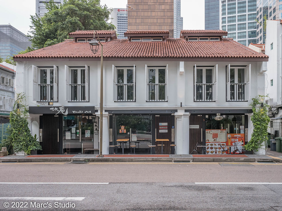
No. 1 Boon Tat Street, May 2022
Stanley Street
This road was named after Captain E Stanley who led a successful operation in 1836 to clear pirates in the Straits of Malacca.
Source: What's in the Name? by Yew Peng Ng, Pg. 399

November 2022
Like other streets named after British royalty, politicians, heroes and military personnel, Stanley Street was named after Edward George Geoffrey Smith-Stanley, 14th Earl of Derby (1799-1869), as well as a statesman who was three-time Prime Minister of the United Kingdom. He was scion of one of Britain's oldest, wealthiest and most powerful families. Lord Stanley as he was known from 1834 to 1851, was well-known for his involvement in the political cession of Hong Kong to Great Britain.
The Stanley Street area was the subject of reclamation by the British. From 1879 to 1885, the British colonial government carried out land reclamation works using the soil of nearby hills as raw material. The reclaimed land between Stanley Street and Telok Ayer Street was then auctioned off in plots and purchased for the construction of shophouses. Along Stanley Street, the neat row of three-storey shophouses, partially hidden behind a lane of tall trees, project the simple, elegant style of early 20th-century Singaporean architecture, The structure has been carefully conserved to retain its original facade and architectural features.
Known as ma cho kiong hi tai au boi in Hokkien, it means "behind the ma cho temple theatrical stage". The Singapore Hokkien Huay Kuan is located on this street.
Source: Singapore Street Names 4th Edition by Victor R. Savage and Brenda S.A. Yeo, Page 480

November 2022

November 2022


Comments